The biggest collection of maps for PowerPoint in the world... and it's free!
BeGraphic is the first solution to give free GIS (Geographical Information System) inside Microsoft Office,
by giving:
- free editable maps of the world (continents, countries, states, counties... usable as clipart images).
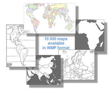
- a complete collection of 10,000 professional maps (this is the largest collection of maps for PowerPoint in the world).
- interactive maps: dynamic data-driven colors, based on cells format (including conditional formatting and live-data update).
- any customization of maps and plans, to build your own geographical data visualization (custom map, sales territory, housing scheme, theater seats booking, plane statistics occupancy, warehouse usage, building services and maintenance, shipyard's assembly planning...).
|
Our users

|
Download more than 10,000 maps for PowerPoint & make them interactive with BeGraphic.
To promote the coming version Pro, BeGraphic offers for free 4 key functions, including the largest range of maps for PowerPoint in its "version Lite". Since the beginning of 2010, several thousands of users are rushing to use BeGraphic to build free custom maps in PowerPoint or Excel.
BeGraphic gives you for free the largest editable PowerPoint vector map range with 10,000 maps (as a 2010 gift) for presentations, graphic design, web & more. All these maps are 100% editable and scalable in PowerPoint, Excel or any vector graphic tool as Adobe Illustrator. They are professionally designed, perfectly optimized for business presentation requirements and ready to customize.
Creating thematic maps for Business or Marketing such as territory maps or sales maps is simply because all countries, states and counties are individual selectable shapes. BeGraphic gives you the opportunity to create effortless dynamic custom maps. Thematic maps are also known as tinted maps, choropleth maps, intensity maps, dynamic maps or data-driven maps.
All shapes can be data-driven by cells in order to create dynamic maps depending on values. We advise you using the conditional formatting with fill colors which is a useful feature of Excel. once your map is customized, you just have to change values and BeGraphic will duplicate the cell's format on the shape's one.
Don't wait, Save Money and Time and download the free version now.

How to make your custom map with BeGraphic?
|

|
Click on the "Geographical map" button and select a map (more than 10,000 maps are available for no cost).
To know how to receive the free 10,000 maps, click here.
|
|
|

|
Prepare your data inside Excel (for data-driven maps):
|
|

|
Set up BeGraphic:
- Select the shape (Country, State, County,FreeForm, Autoshape, Picture...)
- Click on the "Set Parameters" button in the BeGraphic ribbon.
- Define the "source cell" field to get dynamic color. Source cell will control the animation of the shape. Indeed BeGraphic will duplicate the cell's format on the shape's one.
Nb: Repeat this latest action for all shapes to finish your custom map.
|
More explanation
- Video: you can see a tutorial of the choropleth map here.
- Tips and tricks about BeGraphic interactive maps are on the dedicated forum pages.
- The PDF manual is downloadable here.
- Example of thematic map can be used by going:
- Inside the BeGraphic ribbon in Excel, click on the last button called "Example and Help" to access the demo collection.
- In the first sub-menu "Example of usage', pick the "United Kingdom demo" data-driven map.
Why choosing BeGraphic?
Your last questions might be about benchmarking BeGraphic with other simple GIS tools (Geographical Information System), such as "Data Map" in Excel 2000, MapPoint, Google Maps, Google Intensity map, Geo Map, Solap (Spatial Olap), Geoqlik (a not free Qlikview add-on), interactive map alerts and Map components (Xcelsius) or Dundas maps (Reporting Services).
The answer is simple: BeGraphic offers simplicity being 100% pure Microsoft Office addin!
- There is no training needed to use interactive map or to build a custome map in few minutes inside Excel or PowerPoint.
- Your users will directly read your maps, without needing additional software.
- BeGraphic has the largest collection of maps you could expect. On top of that, these 10,000 maps are given for free.
- Any customization: you can draw up maps by yourself.
- You don't have to learn or use macros or a programming language.
Download the Lite Version of BeGraphic (FREE).
Examples of free maps: PowerPoint map, PowerPoint free Templates plan, PowerPoint plug-in for data visualization, PowerPoint editable maps, ppt templates clickable map, free maps, free country, free countries clipart, free federal map, all states map for powerpoint, province, county, counties, territories, area, part, sectors, borders, boundaries, ambit, editable, administrative, districts, cities, your, locations, /, headquarters, sales, local, planning, analyses, with, these, digital, maps, powerpoint, template, business map, marketing map for powerpoint, free maps for presentations, digital vector maps, world map in Powerpoint, earth map in excel, europe free map, india editable map in powerpoint, country maps, powerpoint maps, interactive flash maps, powerpoint map collection, united states maps, powerpoint templates, flash maps, new jersey state maps, nebraska state maps, colorado state maps, north america, mississippi state maps, congressional maps, ireland map, south carolina state map, canada editable map, south dakota state maps africa map, maine state map, scotland editable map, florida state map, wyoming state map, israel editable map, asia map, portugal map, michigan state map, graphic resources maps, editable digital maps vector powerpoint maps illustrator flash, south africa map, usa editable map, connecticut state map for powerpoint, state maps digital vector powerpoint flash and illustrator format, idaho state maps, washington state maps, utah state maps, japan editable map, rhode island state maps, arkansas state maps, oklahoma state maps, venezuela, taiwan, georgia state maps, massachusetts state maps, france editable map, argentina free map, all u.s 50 individual state flash maps, greece free map, poland free map, virgin island free maps, alaska state maps, alabama state maps, finland free map, free map downloads, united arab emirates, sweden editable map, pdf maps, oregon state maps, north carolina state maps, illustrator maps, mexico free map, northern ireland, denmark free map, clickable united states maps, austria editable map, download free powerpoint template backgrounds, saudia arabia free map, minnesota state maps, europe free map, pennsylvania state maps, russia free map, india free map, turkey editable map, australia free map, italy free map, spain free map, texas state maps, louisiana state maps, new mexico state maps, virginia state maps, ohio state maps, powerpoint backgrounds, norway free map, germany free map, continent editable maps, maps for powerpoint, free maps for powerpoint, belgium map for powerpoint, us maps, editable indiana state maps, lebanon free map, new zealand free map, free website maps, brazil map for powerpoint, england free map, pakistan free map, north dakota state maps, puerto rico free maps, north korea free map, tennessee state maps for powerpoint, illinois state maps, digital map collections, wisconsin state maps, california state free maps, new york state maps, free map collection, missouri state maps, vermont state maps, clickable website maps, clikable free map for powerpoint, netherlands free map, iraq editable map, china free map for powerpoint, cuba editable map, south america free map, nevada state maps, iran free map, new hampshire state maps, powerpoint graphics, switzerland free map, indonesia free map, egypt map for powerpoint, kentucky state maps, south korea free map, arizona state maps, iowa state maps, city county list, afghanistan free map, west virginia state maps, continents free map for powerpoint, kansas state maps, delaware state map, montana state maps, maryland state maps, us state maps, available interactive flash maps, city county databases, hawaii state maps, digital vector maps, interactive flash maps, free united states maps, illustrator maps, editable digital maps vector powerpoint maps illustrator flash, congressional maps, flash maps, map wizard, continents, powerpoint templates, powerpoint maps,world maps, editable digital maps vector powerpoint maps illustrator flash, royalty-free digital maps, digital map collections, powerpoint backgrounds, powerpoint graphics, country maps, clickable united states maps, state maps digital vector powerpoint flash and illustrator format, clickable website maps, city county databases, powerpoint map collection, maps for powerpoint, pdf maps
free powerpoint map, ppt free - map, powerpoint map, free clipart, microsoft clipart, clip arts, using maps in PowerPoint, free powerpoint templates, free vector & bump maps, insert a map in powerpoint, free presentations in PowerPoint format for Themes of Geography, Maps and Map Skills, Landforms including Coasts, Deserts, Islands,World of Maps Clip Art collection of royalty free editable PowerPoint and Illustrator maps. Large collection of World, US, State, County, World Regions, create a custom road or metro map in Visio and copy and paste it into PowerPoint, a world atlas of facts flags and maps and free clip art every continent, country, dependency, custom maps Commercial & Corporate PowerPoint, PowerPoint Templates, ppt free - maps for presentations, push pin PowerPoint maps are a great new addition to our free downloadable templates selection. These are maps of individual countries, Free editable PowerPoint maps of North and Central America. Here you will find the latest editions to our editable Vector PowerPoint map range. These maps are made for microsoft office, Looking for editable PowerPoint maps? Instantly download United States, India and other countries around the world in PowerPoint format, the largest collection of royalty-free digital vector maps, interactive flash maps, PowerPoint geographical maps and plans, World map PowerPoint template shows a map of the world over a gradient color. cell-driven graphic, data driven charts in powerpoint and excel, value driven charts, more than free sample, our maps library is free, download free sphere powerpoint templates and backgrounds for powerpoint presentations, free World, Map, Geography, Globe, Countries, Continents, Earth maps in Excel spreadsheet an PowerPoint presentation tool, Editable Vector USA Map, USA State, Europe, World Maps for PowerPoint Presentations, Illustrator, web site maps, Download to Your Computer, Editable Outline, Free PowerPoint templates and Free PowerPoint backgrounds for presentations ready to use, complex data-driven graphics directly from Excel, dataHigh-quality editable maps of the United States of America with states for your PowerPoint presentations, You can get the free US ppt that available for you to edit. maps can be edited, colored and scaled directly in PowerPoint. Not only Powerpoint USA map, you can also choose editable maps of Canada, India, Australia, New Zealand and hundreds of other countries, This section lists free presentations in PowerPoint format for Geography, Maps and Map Skills, Landforms including Coasts, Lakes, Deserts, Islands, Mountains, Plains, Oceans, Rivers, plus Regions of the World, Communities, Continents, Countries & counties, Feel free to copy the autoshapes and freeform formats, Find fully editable, digital maps of the World & Globe in PowerPoint (PPT) Format from the largest Map collection for PowerPoint and Excel, Royalty Free Vector Maps in Adobe Illustrator and PDF Format to use with Excel spreadsheet and PowerPoint, Detailed maps for PowerPoint, easily edited, adjusted, scaled and colored. Maps & Flags, More than 1000 templates, designs and slides as a free download, globe, earth, global, sphere, map, world map, planet, world, world wide, blue, free powerpoint templates, freeware, shareware, free, no cost, zeo cost, free gauge chart, Downloadable, Royalty Free, Editable, Digital Maps for PowerPoint. ... complex data-driven charts directly from Excel data, PowerPoint maps are completely editable for sales and marketing presentations,